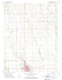
1973 Map of Phillipsburg North
USGS Topo · Published 1975About this map
Phillipsburg serves as the focal point of this 1973 survey, showing a well-established county seat defined by its industrial and civic infrastructure. The presence of a large Refinery and Substation near the Chicago Rock Island and Pacific railroad tracks highlights the town's role in regional processing and transit. The street grid is densely marked with local landmarks including the Courthouse, Library, and Jr High Sch, alongside a municipal Park and Golf Course.
Find a feature on this map
28 named features on this map. Tap any name to fly to it.
Don’t see what you’re looking for? This feature index may not catch every label — zoom into the map to look around manually.
Map Details
Editions of this 1973 Phillipsburg North Map
This is the sole edition of this map. No revisions or reprints were ever made.
Other maps of this area

1893 · Phillipsburg
USGS Topo · 1:125,000

1955 · Beloit
USGS Topo · 1:250,000

1959 · Beloit
USGS Topo · 1:250,000

1968 · Woodruff
USGS Topo · 1:24,000

1972 · Speed
USGS Topo · 1:24,000

1972 · Kirwin Reservoir
USGS Topo · 1:24,000

1972 · Phillipsburg South
USGS Topo · 1:24,000

1973 · Stuttgart NE
USGS Topo · 1:24,000
1973 · Kensington NW
USGS Topo · 1:24,000
1973 · Gretna
USGS Topo · 1:24,000