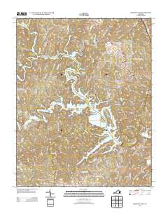
2013 Map of Philpott Lake
USGS Topo · Published 2013About this map
Philpott Lake dominates this 2013 survey of the Virginia landscape, where the Smith River is impounded to form a complex network of coves and islands. The shoreline is marked by prominent landforms such as Horseshoe Point, Rabbit Island, and Mize Point, while the surrounding hills are punctuated by Little Mountain and Stuarts Knob. Settlements such as Philpott, Dodson, and Prilliman are connected by a web of rural routes, including Heidelbach School Rd and Union Bridge Rd, reflecting the region's transition from traditional agricultural hollows to a recreation-centered economy.
Find a feature on this map
145 named features on this map. Tap any name to fly to it.
Don’t see what you’re looking for? This feature index may not catch every label — zoom into the map to look around manually.
Map Details
Editions of this 2013 Philpott Lake Map
This is the sole edition of this map. No revisions or reprints were ever made.
Other maps of this area

1924 · Martinsville
USGS Topo · 1:48,000

1925 · Rocky Mount
USGS Topo · 1:48,000

1926 · Martinsville
USGS Topo · 1:62,500

1926 · Critz
USGS Topo · 1:48,000

1927 · Rocky Mount
USGS Topo · 1:62,500

1927 · Martinsville
USGS Topo · 1:62,500

1928 · Critz
USGS Topo · 1:62,500

1944 · Martinsville
USGS Topo · 1:62,500

1944 · Rocky Mount
USGS Topo · 1:62,500

1953 · Winston-Salem
USGS Topo · 1:250,000