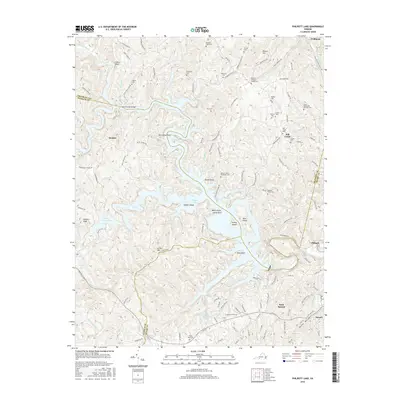
2016 Map of Philpott Lake
USGS Topo · Published 2016About this map
Philpott Lake dominates this rugged corner of the Blue Ridge foothills, its deeply indented shoreline creating numerous peninsulas and points such as Beech Point and Horseshoe Point. The impoundment of the Smith River transformed this landscape, yet the map preserves the names of the older terrestrial world, including family-named heights like Brown Hill and Stuarts Knob. To the west, the smaller Fairy Stone Lake sits near the junction of Franklin, Patrick, and Henry counties.
Find a feature on this map
134 named features on this map. Tap any name to fly to it.
Don’t see what you’re looking for? This feature index may not catch every label — zoom into the map to look around manually.
Map Details
Editions of this 2016 Philpott Lake Map
This is the sole edition of this map. No revisions or reprints were ever made.
Other maps of this area

1924 · Martinsville
USGS Topo · 1:48,000

1925 · Rocky Mount
USGS Topo · 1:48,000

1926 · Martinsville
USGS Topo · 1:62,500

1926 · Critz
USGS Topo · 1:48,000

1927 · Rocky Mount
USGS Topo · 1:62,500

1927 · Martinsville
USGS Topo · 1:62,500

1928 · Critz
USGS Topo · 1:62,500

1944 · Martinsville
USGS Topo · 1:62,500

1944 · Rocky Mount
USGS Topo · 1:62,500

1953 · Winston-Salem
USGS Topo · 1:250,000