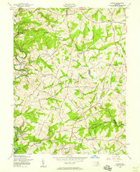
1957 Map of Phoenix
USGS Topo · Published 1958About this map
My Ladys Manor and the surrounding rural districts of northern Baltimore County define this landscape as it appeared in the late 1950s. The map captures a transition from traditional agricultural life toward mid-century development, evidenced by the cluster of schools and churches like Shepperd Sch and Chestnut Grove Ch that served these growing rural communities. The eastern edge of the Loch Raven Reservoir provides a natural anchor in the southwest, while the Pennsylvania Railroad snakes through the valley of the Gunpowder Falls, linking settlements such as Phoenix and Monkton.
Find a feature on this map
69 named features on this map. Tap any name to fly to it.
Don’t see what you’re looking for? This feature index may not catch every label — zoom into the map to look around manually.
Map Details
Editions of this 1957 Phoenix Map
4 editions found
Other maps of this area

1893 · Gunpowder
USGS Topo · 1:62,500

1894 · Baltimore
USGS Topo · 1:62,500

1898 · Tolchester
USGS Topo · 1:125,000

1899 · Baltimore
USGS Topo · 1:62,500

1900 · Parkton
USGS Topo · 1:62,500

1901 · Belair
USGS Topo · 1:62,500

1901 · Gunpowder
USGS Topo · 1:62,500

1902 · Parkton
USGS Topo · 1:62,500

1903 · Tolchester
USGS Topo · 1:125,000

1904 · Baltimore
USGS Topo · 1:62,500