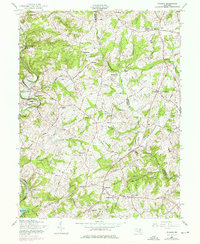
1957 Map of Phoenix
USGS Topo · Published 1976About this map
My Ladys Manor defines much of the rolling landscape across this 1957 revision of the Baltimore and Harford county borderlands. The region's agricultural and social identity is rooted in historic crossroads like Shepperd, Madonna, and Monkton, where the Penn Central line follows the winding course of Gunpowder Falls. To the south, the waters of the Loch Raven Reservoir meet the burgeoning suburban growth around Jacksonville and Phoenix. Numerous rural institutions anchor the local history, from the Shepperd Sch to Wesley Chapel and the Fairview Cem. The presence of the Elkridge-Harford Hunt Club and the Mason Dixon Trail reflects the area's equestrian and recreational character as it evolved during the mid-20th century.
Find a feature on this map
47 named features on this map. Tap any name to fly to it.
Don’t see what you’re looking for? This feature index may not catch every label — zoom into the map to look around manually.
Map Details
Editions of this 1957 Phoenix Map
4 editions found
Other maps of this area

1893 · Gunpowder
USGS Topo · 1:62,500

1894 · Baltimore
USGS Topo · 1:62,500

1898 · Tolchester
USGS Topo · 1:125,000

1899 · Baltimore
USGS Topo · 1:62,500

1900 · Parkton
USGS Topo · 1:62,500

1901 · Belair
USGS Topo · 1:62,500

1901 · Gunpowder
USGS Topo · 1:62,500

1902 · Parkton
USGS Topo · 1:62,500

1903 · Tolchester
USGS Topo · 1:125,000

1904 · Baltimore
USGS Topo · 1:62,500