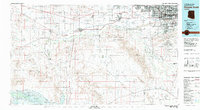
1981 Map of Phoenix South
USGS Topo · Published 1981About this map
The Gila River and Salt River confluence anchors this 1981 survey, revealing a landscape defined by industrial agriculture and early aviation infrastructure. In the western reaches, the Southern Pacific Railroad connects remote points like Arlington Station and Palo Verde, while the Buckeye Hills and Gila Bend Mountains rise above the irrigated expanses of the Buckeye valley. The map documents significant cultural boundaries, including large portions of the Gila River Indian Reservation and the Ak Chin Indian Reservation. Military and civil aviation footprints are prominent at Luke Aux Field No 5 and the Phoenix-Litchfield Municipal Airport. Mining history is preserved at the Buckeye Copper Mine and Webb Mountain Mine, while the southern expanse transitions into the arid Rainbow Valley near Sevenmile Mountain.
Find a feature on this map
73 named features on this map. Tap any name to fly to it.
Don’t see what you’re looking for? This feature index may not catch every label — zoom into the map to look around manually.
Map Details
Editions of this 1981 Phoenix South Map
2 editions found
Other maps of this area

1904 · Camelback
USGS Topo · 1:62,500

1906 · Camelsback
USGS Topo · 1:62,500

1912 · Phoenix
USGS Topo · 1:62,500

1913 · Mesa
USGS Topo · 1:62,500

1913 · Maricopa
USGS Topo · 1:62,500

1914 · Gila Butte
USGS Topo · 1:62,500

1914 · Phoenix
USGS Topo · 1:62,500

1915 · Mesa
USGS Topo · 1:62,500

1915 · Maricopa
USGS Topo · 1:62,500

1917 · Gila Butte
USGS Topo · 1:62,500