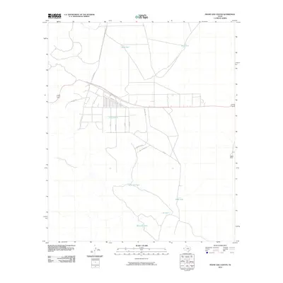
2010 Map of Phone Line Canyon
USGS Topo · Published 2010About this map
Water management dominates this arid landscape of Hudspeth County, where a network of cattle tanks like Phone Line Tank and Reddy Tank defines the land use outside of developed pockets. The residential grid of the Loma Linda Estates area is evident along the northern reach of Republic Blvd, featuring a mix of named thoroughfares including Fiesta Dr and Hong Kong St. These street names contrast sharply with the traditional ranching infrastructure that surrounds the settlement.
Find a feature on this map
19 named features on this map. Tap any name to fly to it.
Don’t see what you’re looking for? This feature index may not catch every label — zoom into the map to look around manually.
Map Details
Editions of this 2010 Phone Line Canyon Map
This is the sole edition of this map. No revisions or reprints were ever made.
Other maps of this area

1896 · El Paso
USGS Topo · 1:125,000

1903 · Cerro Alto
USGS Topo · 1:125,000

1908 · El Paso
USGS Topo · 1:125,000

1939 · Heuco Tanks
USGS Topo · 1:62,500

1940 · Heuco Tanks
USGS Topo · 1:62,500

1941 · Clint
USGS Topo · 1:62,500

1941 · Heuco Mountains
USGS Topo · 1:62,500

1942 · Borrego
USGS Topo · 1:62,500

1943 · Heuco Mountains
USGS Topo · 1:62,500

1944 · Heuco Tanks
USGS Topo · 1:62,500