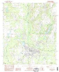
1985 Map of Picayune
USGS Topo · Published 1985About this map
Picayune serves as the primary urban center for this mid-1980s landscape, positioned where the East Hobolochitto Creek and West Hobolochitto Creek converge. The city's growth is anchored by infrastructure like the Municipal Airport and a prominent Radio Range Station, reflecting its role as a regional hub in Pearl River County. To the north and east, smaller settlements like Carriere, Ozona, and Richardson dot the rail and road corridors, while the planned waterside community around Hide-A-Way Lake indicates the residential expansion of the era.
Find a feature on this map
31 named features on this map. Tap any name to fly to it.
Don’t see what you’re looking for? This feature index may not catch every label — zoom into the map to look around manually.
Map Details
Editions of this 1985 Picayune Map
2 editions found
Other maps of this area

1914 · Nicholson
USGS Topo · 1:62,500

1921 · Nicholson
USGS Topo · 1:62,500

1935 · Slidell
USGS Topo · 1:62,500

1939 · Slidell
USGS Topo · 1:62,500

1941 · Honey Island
USGS Topo · 1:31,680

1942 · Walkiah Bluff
USGS Topo · 1:31,680

1942 · Pools Bluff
USGS Topo · 1:31,680

1950 · Slidell
USGS Topo · 1:62,500

1953 · Mobile
USGS Topo · 1:250,000

1955 · Nicholson
USGS Topo · 1:24,000