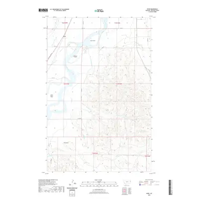
2020 Map of Piche
USGS Topo · Published 2020About this map
The Yellowstone River anchors this Richland County landscape, winding through a complex system of islands and sloughs that define the river's character in eastern Montana. The settlement of Piche sits near the Main Canal, highlighting the area's agricultural reliance on irrigation systems alongside the natural waterway. The topography is marked by several large river features, including Buella Island, Diamond Island, and the Seven Sisters Island, which suggest a shifting and braided river channel over time. The historic Lewis and Clark Trl follows the western bank, tracing the same path as early explorers through this region. Moving away from the valley, the terrain rises toward distinctive high points like The Pyramid, while numerous drainages such as Sagebrush Cr and Coal Bank Slough carve into the surrounding plains.
Find a feature on this map
30 named features on this map. Tap any name to fly to it.
Don’t see what you’re looking for? This feature index may not catch every label — zoom into the map to look around manually.
Map Details
Editions of this 2020 Piche Map
This is the sole edition of this map. No revisions or reprints were ever made.
Other maps of this area

1909 · Glendive
USGS Topo · 1:250,000

1954 · Glendive
USGS Topo · 1:250,000

1957 · Glendive
USGS Topo · 1:250,000

1958 · Glendive
USGS Topo · 1:250,000

1966 · Savage
USGS Topo · 1:24,000

1966 · Crane NE
USGS Topo · 1:24,000

1966 · Piche
USGS Topo · 1:24,000

1966 · Crane
USGS Topo · 1:24,000

1966 · Sidney NE
USGS Topo · 1:24,000

1966 · Skaar NW
USGS Topo · 1:24,000