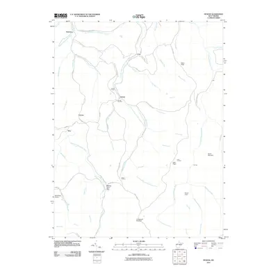
2010 Map of Pickens
USGS Topo · Published 2010About this map
Helvetia and Pickens anchor this study of the West Virginia highlands, where isolated mountain settlements follow the winding paths of the Right Fork Buckhannon River and its numerous tributaries. This survey details the remote character of the region, where tiny communities like Newlonton, Czar, and Silica are linked by winding roads such as the Old Helvetia-Newlonton Rd and Helvetia-Adolph Rd. The map illustrates a landscape defined by significant elevations, including Turkeybone Mountain and Beech Mountain. Local genealogy and settlement history are well-represented by the inclusion of the Helvetia Post Office, the Pickens Post Office, and several family-named burial sites like Hicks Cemetery. The intricate network of runs, including Marsh Fork and Trout Run, underscores the water-carved geography that has historically dictated travel and development in this part of Randolph County.
Find a feature on this map
67 named features on this map. Tap any name to fly to it.
Don’t see what you’re looking for? This feature index may not catch every label — zoom into the map to look around manually.
Map Details
Editions of this 2010 Pickens Map
This is the sole edition of this map. No revisions or reprints were ever made.
Other maps of this area

1893 · Buckhannon
USGS Topo · 1:125,000

1896 · Buckhannon
USGS Topo · 1:125,000

1897 · Buckhannon
USGS Topo · 1:125,000

1912 · Sago
USGS Topo · 1:48,000

1912 · Crawford
USGS Topo · 1:48,000

1913 · Hacker Valley
USGS Topo · 1:48,000

1913 · Pickens
USGS Topo · 1:48,000

1914 · Sago
USGS Topo · 1:62,500

1914 · Crawford
USGS Topo · 1:62,500

1915 · Hacker Valley
USGS Topo · 1:62,500