
1915 Map of Pickens
USGS Topo · Published 1915About this map
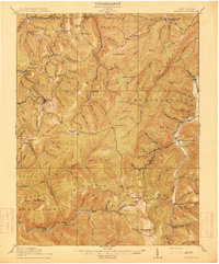
The B and O RR and the Lumber RR pierce the mountainous landscape of Randolph and Upshur counties, marking an era where timber and rail shaped the West Virginia interior. This 1913 survey details the village of Pickens, a critical terminal for logging operations, alongside the nearby Swiss-German settlement of Helvetia. The topography is dominated by prominent ridges like Palace Ridge and Beech Mountain, while the Middle Fork River and Buckhannon River systems provide the primary drainage for the highland terrain.
Find a feature on this map
110 named features on this map. Tap any name to fly to it.
Don’t see what you’re looking for? This feature index may not catch every label — zoom into the map to look around manually.
Map Details
Editions of this 1915 Pickens Map
4 editions found
Other maps of this area

1889 · Beverly
USGS Topo · 1:125,000

1891 · Huntersville
USGS Topo · 1:125,000

1892 · Beverly
USGS Topo · 1:125,000

1893 · Buckhannon
USGS Topo · 1:125,000

1894 · Huntersville
USGS Topo · 1:125,000

1896 · Buckhannon
USGS Topo · 1:125,000

1897 · Buckhannon
USGS Topo · 1:125,000

1901 · Monterey
USGS Topo · 1:125,000

1909 · Elkins
USGS Topo · 1:62,500

1912 · Sago
USGS Topo · 1:48,000