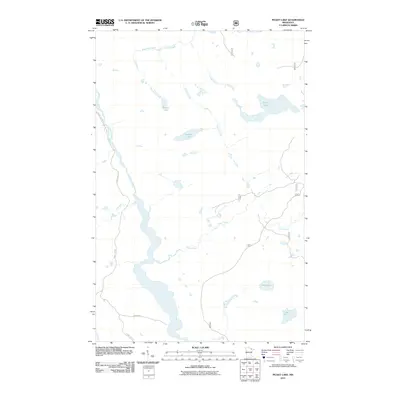
2011 Map of Picket Lake
USGS Topo · Published 2011About this map
Vermilion River and its surrounding wetlands define this portion of northeast St. Louis County, shown here in a detailed topographic survey from the early 21st century. The landscape is dominated by a complex hydrographic network, including isolated basins like Mankus Lake and Picket Lake. This area of the North Woods is characterized by its drainage patterns, where smaller tributaries such as Brendvold Creek and Finstad Creek feed into the larger river system. Human infrastructure is limited to secondary routes and forest access, with Crane Lake Rd and Ahlgren Rd providing the primary passage through the timbered terrain. The arrangement of water bodies like Lake Lon and Lake Alf suggests a glacial landscape of kettle lakes and slow-moving streams, reflecting the quiet, undeveloped character of this Minnesota wilderness.
Find a feature on this map
13 named features on this map. Tap any name to fly to it.
Don’t see what you’re looking for? This feature index may not catch every label — zoom into the map to look around manually.
Map Details
Editions of this 2011 Picket Lake Map
This is the sole edition of this map. No revisions or reprints were ever made.
Other maps of this area

1954 · Hibbing
USGS Topo · 1:250,000

1954 · International Falls
USGS Topo · 1:250,000

1956 · Sioux Pine Island
USGS Topo · 1:24,000

1956 · Vermilion Dam
USGS Topo · 1:24,000

1957 · Hibbing
USGS Topo · 1:250,000

1957 · International Falls
USGS Topo · 1:250,000

1958 · International Falls
USGS Topo · 1:250,000

1958 · Hibbing
USGS Topo · 1:250,000

1963 · Echo Lake
USGS Topo · 1:24,000

1963 · Astrid Lake
USGS Topo · 1:24,000