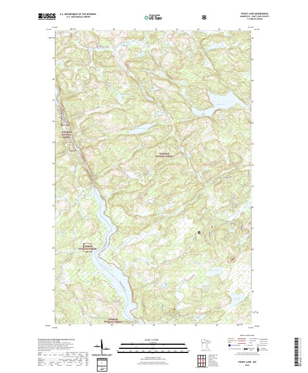
2022 Map of Picket Lake
USGS Topo · Published 2022About this map
The Vermilion River carves a deep path through the southwestern portion of this landscape, which is defined by the dense forest cover of the Superior National Forest. This 2022 survey captures a remote wilderness character where transportation is largely limited to unpaved access points and recreational trails. In the northern reaches, small clearings such as Hoffmans and Hoffmans Spur B suggest past or present timber operations or local staging areas. The hydrology of the region is interconnected by numerous small water bodies and drainage systems, including Picket Lake, Finstad Lake, and Mankus Lake. Access to these interior waters is provided by a network of specialized paths like the Table Rock Falls Trl and Maude Creek Trl, illustrating the contemporary focus on managed forest use and waterway protection within Saint Louis County.
Find a feature on this map
28 named features on this map. Tap any name to fly to it.
Don’t see what you’re looking for? This feature index may not catch every label — zoom into the map to look around manually.
Map Details
Editions of this 2022 Picket Lake Map
This is the sole edition of this map. No revisions or reprints were ever made.
Other maps of this area

1954 · Hibbing
USGS Topo · 1:250,000

1954 · International Falls
USGS Topo · 1:250,000

1956 · Sioux Pine Island
USGS Topo · 1:24,000

1956 · Vermilion Dam
USGS Topo · 1:24,000

1957 · Hibbing
USGS Topo · 1:250,000

1957 · International Falls
USGS Topo · 1:250,000

1958 · International Falls
USGS Topo · 1:250,000

1958 · Hibbing
USGS Topo · 1:250,000

1963 · Echo Lake
USGS Topo · 1:24,000

1963 · Astrid Lake
USGS Topo · 1:24,000