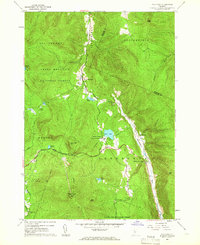
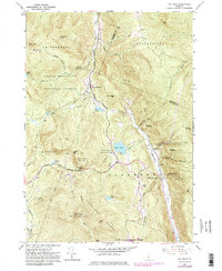
1961 Map of Pico Peak
USGS Topo · Published 1966About this map
Pico Peak dominates the landscape of this 1961 survey, where the intersecting paths of the Long Trail and Appalachian Trail converge near Sherburne Pass. The map details a mountain environment managed through several public lands, including the Green Mountain National Forest and Gifford Woods State Forest Park. Settlement is concentrated along the narrow river valleys, particularly where the Tweed River and Ottauquechee River cut through the terrain.
Find a feature on this map
38 named features on this map. Tap any name to fly to it.
Don’t see what you’re looking for? This feature index may not catch every label — zoom into the map to look around manually.
Map Details
Editions of this 1961 Pico Peak Map
5 editions found
Other maps of this area

1891 · Rutland
USGS Topo · 1:62,500

1893 · Rutland
USGS Topo · 1:62,500

1911 · Woodstock
USGS Topo · 1:62,500

1913 · Woodstock
USGS Topo · 1:62,500

1915 · Rochester
USGS Topo · 1:62,500

1917 · Rochester
USGS Topo · 1:62,500

1919 · Royalton
USGS Topo · 1:62,500

1924 · Randolph
USGS Topo · 1:48,000

1926 · Randolph
USGS Topo · 1:62,500

1943 · Woodstock
USGS Topo · 1:62,500