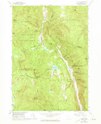
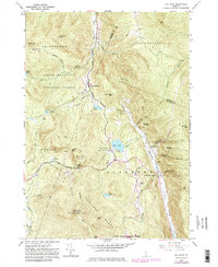
1961 Map of Pico Peak
USGS Topo · Published 1973About this map
Pico Peak dominates the southern skyline of this 1961 survey, a landscape defined by the intersection of early outdoor recreation and traditional rural Vermont life. The map documents the mid-century expansion of Ski Lifts on the slopes of the Coolidge Range, while maintaining the wild character of the Green Mountain National Forest. Central to this area is Sherburne Pass, where the Long Trail and the Appalachian Trail converge near Deer Leap Rock, a hub for hikers and travelers long before the modern resort era.
Find a feature on this map
60 named features on this map. Tap any name to fly to it.
Don’t see what you’re looking for? This feature index may not catch every label — zoom into the map to look around manually.
Map Details
Editions of this 1961 Pico Peak Map
5 editions found
Other maps of this area

1891 · Rutland
USGS Topo · 1:62,500

1893 · Rutland
USGS Topo · 1:62,500

1911 · Woodstock
USGS Topo · 1:62,500

1913 · Woodstock
USGS Topo · 1:62,500

1915 · Rochester
USGS Topo · 1:62,500

1917 · Rochester
USGS Topo · 1:62,500

1919 · Royalton
USGS Topo · 1:62,500

1924 · Randolph
USGS Topo · 1:48,000

1926 · Randolph
USGS Topo · 1:62,500

1943 · Woodstock
USGS Topo · 1:62,500