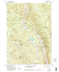
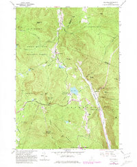
1961 Map of Pico Peak
USGS Topo · Published 1981About this map
Pico Peak and the surrounding Coolidge Range dominate this Vermont landscape, where the Appalachian Trail and Long Trail intersect near Sherburne Pass. The map captures a moment in the mid-20th century before the significant expansion of modern alpine infrastructure, showing the early footprints of ski lifts on the western slopes of the peak. Along the valley floor, the Ottauquechee River and South Branch Tweed River define the settlement patterns, with Sherburne Center and North Sherburne serving as local hubs. For those interested in regional heritage, the sheet identifies historic markers like the Sherburne Valley Sch and Riverside Cem. The preservation of the terrain is evident through the overlapping boundaries of the Green Mountain National Forest and Gifford Woods State Forest Park, which protect landmarks like Deer Leap Mountain and Colton Pond.
Find a feature on this map
55 named features on this map. Tap any name to fly to it.
Don’t see what you’re looking for? This feature index may not catch every label — zoom into the map to look around manually.
Map Details
Editions of this 1961 Pico Peak Map
5 editions found
Other maps of this area

1891 · Rutland
USGS Topo · 1:62,500

1893 · Rutland
USGS Topo · 1:62,500

1911 · Woodstock
USGS Topo · 1:62,500

1913 · Woodstock
USGS Topo · 1:62,500

1915 · Rochester
USGS Topo · 1:62,500

1917 · Rochester
USGS Topo · 1:62,500

1919 · Royalton
USGS Topo · 1:62,500

1924 · Randolph
USGS Topo · 1:48,000

1926 · Randolph
USGS Topo · 1:62,500

1943 · Woodstock
USGS Topo · 1:62,500