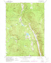
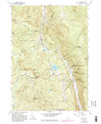
1961 Map of Pico Peak
USGS Topo · Published 1981About this map
Sherburne Center and North Sherburne serve as the primary hubs of activity in this high-elevation landscape, where the confluence of the Ottauquechee River and various mountain brooks shaped early mountain settlement. The terrain is dominated by the massive summits of the Coolidge Range, including Pico Peak and Little Pico, which are etched with ski lifts and radio towers that indicate the area's development for recreation and communication by the early 1960s.
Find a feature on this map
59 named features on this map. Tap any name to fly to it.
Don’t see what you’re looking for? This feature index may not catch every label — zoom into the map to look around manually.
Map Details
Editions of this 1961 Pico Peak Map
5 editions found
Other maps of this area

1891 · Rutland
USGS Topo · 1:62,500

1893 · Rutland
USGS Topo · 1:62,500

1911 · Woodstock
USGS Topo · 1:62,500

1913 · Woodstock
USGS Topo · 1:62,500

1915 · Rochester
USGS Topo · 1:62,500

1917 · Rochester
USGS Topo · 1:62,500

1919 · Royalton
USGS Topo · 1:62,500

1924 · Randolph
USGS Topo · 1:48,000

1926 · Randolph
USGS Topo · 1:62,500

1943 · Woodstock
USGS Topo · 1:62,500