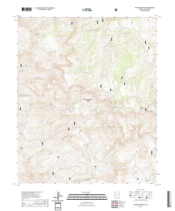
2021 Map of Picture Mountain
USGS Topo · Published 2021About this map
Sierra Ancha dominates this landscape within the Tonto National Forest, where a network of seasonal drainages and springs defines the high desert topography. This modern survey captures the complex drainage patterns feeding into Gun Cr and Del Shay Cr, which carve through deep formations like Bear Head Canyon and Quartz Ledge Canyon. The area is characterized by prominent peaks and mesas, including Picture Mtn, Mistake Peak, and the expansive Horse Range Mesa to the south. Numerous named water sources, such as Hymn Book Spring, Rock House Spring, and Hidden Spring, indicate the vital locations of reliable water in an otherwise arid environment. The map details the transition from the low-lying Greenback Valley to the elevated Del Shay Basin, providing a precise record of the natural landmarks and geographic features of this Gila County terrain.
Find a feature on this map
48 named features on this map. Tap any name to fly to it.
Don’t see what you’re looking for? This feature index may not catch every label — zoom into the map to look around manually.
Map Details
Editions of this 2021 Picture Mountain Map
This is the sole edition of this map. No revisions or reprints were ever made.
Other maps of this area

1887 · Verde
USGS Topo · 1:250,000

1892 · Verde
USGS Topo · 1:250,000

1907 · Roosevelt
USGS Topo · 1:125,000

1909 · Four Peaks
USGS Topo · 1:125,000

1912 · Roosevelt
USGS Topo · 1:125,000

1936 · Payson
USGS Topo · 1:48,000

1937 · Diamond Butte
USGS Topo · 1:48,000

1942 · Payson
USGS Topo · 1:62,500

1943 · Diamond Butte
USGS Topo · 1:62,500

1954 · Holbrook
USGS Topo · 1:250,000