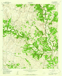
1958 Map of Pidcoke
USGS Topo · Published 1961About this map
Slater and the northern reaches of the Fort Hood Military Reservation anchor this mid-century survey of the Central Texas landscape. The terrain is defined by the winding course of Cowhouse Creek and its various tributaries, including Bee House Creek and Perriman Creek, which carve through the limestone-rich topography. The influence of the military installation is evident in the southeast corner, while the surrounding areas retain a rural character marked by scattered agricultural activity and resource extraction at numerous Borrow Pit sites.
Find a feature on this map
9 named features on this map. Tap any name to fly to it.
Don’t see what you’re looking for? This feature index may not catch every label — zoom into the map to look around manually.
Map Details
Editions of this 1958 Pidcoke Map
2 editions found
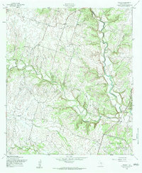
Other maps of this area

1887 · Lampasas
USGS Topo · 1:125,000

1894 · Lampasas
USGS Topo · 1:125,000

1894 · Gatesville
USGS Topo · 1:125,000

1947 · Fort Hood
USGS Topo · 1:62,500

1947 · Fort Hood
USGS Topo · 1:24,000

1947 · Purmela
USGS Topo · 1:62,500

1947 · Gatesville West
USGS Topo · 1:24,000

1947 · Pidcoke
USGS Topo · 1:24,000

1947 · Purmela
USGS Topo · 1:24,000

1947 · Shell Mountains
USGS Topo · 1:24,000