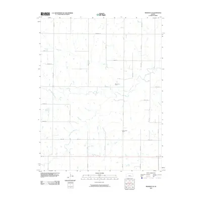
2009 Map of Piedmont NE
USGS Topo · Published 2009About this map
Otter Creek and its various tributaries, including North Branch Otter Creek and South Branch Otter Creek, dominate the drainage patterns of this Greenwood County landscape. The area is characterized by a sparse, grid-based road network that reflects the agricultural and ranching heritage of the region. Notable family-named thoroughfares such as Broddle Rd, Sauerwine Rd, and Schouten Rd provide access to the rural properties and small operations found throughout the quadrangle.
Find a feature on this map
35 named features on this map. Tap any name to fly to it.
Don’t see what you’re looking for? This feature index may not catch every label — zoom into the map to look around manually.
Map Details
Editions of this 2009 Piedmont NE Map
This is the sole edition of this map. No revisions or reprints were ever made.
Other maps of this area

1885 · Eureka
USGS Topo · 1:125,000

1888 · Eureka
USGS Topo · 1:125,000

1894 · Eureka
USGS Topo · 1:125,000

1939 · Severy
USGS Topo · 1:62,500

1941 · Severy
USGS Topo · 1:62,500

1955 · Wichita
USGS Topo · 1:250,000

1958 · Wichita
USGS Topo · 1:250,000
1964 · Piedmont SW
USGS Topo · 1:24,000

1964 · Piedmont NW
USGS Topo · 1:24,000
1964 · Piedmont NE
USGS Topo · 1:24,000