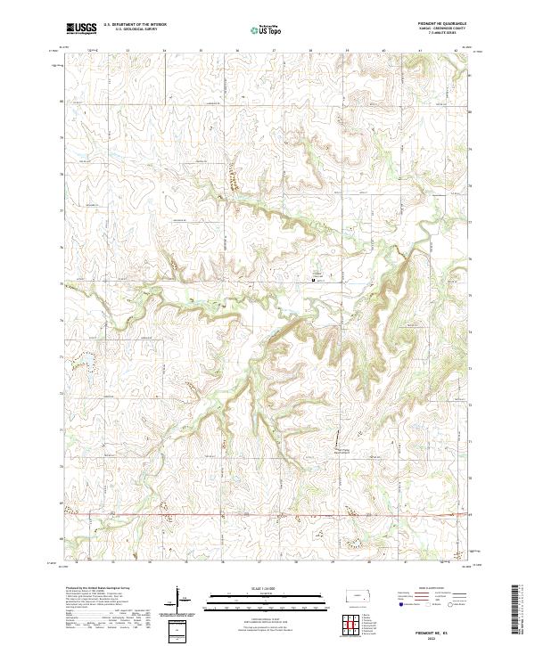
2022 Map of Piedmont NE
USGS Topo · Published 2022About this map
The branching headwaters of Otter Creek define this rural landscape in Greenwood County, where the terrain is marked by the dendritic patterns of Tadpole Cr and South Branch Otter Creek. The region reflects a traditional Kansas agricultural settlement pattern, organized along a strict grid of section lines and township boundaries such as t27s r10e. Small-scale aviation and local genealogy are represented by distinct landmarks including the Stuber Flying Ranch Airport in the south-central portion of the quadrangle and the Pleasant View Cem situated near the intersection of 60th St and Co Rd 24. This modern digital survey documents the persistence of family-named roads and remote farmsteads that have shaped the county for generations, connected by a network of thoroughfares like Sauerwine Rd and Norman Rd.
Find a feature on this map
58 named features on this map. Tap any name to fly to it.
Don’t see what you’re looking for? This feature index may not catch every label — zoom into the map to look around manually.
Map Details
Editions of this 2022 Piedmont NE Map
This is the sole edition of this map. No revisions or reprints were ever made.
Other maps of this area

1885 · Eureka
USGS Topo · 1:125,000

1888 · Eureka
USGS Topo · 1:125,000

1894 · Eureka
USGS Topo · 1:125,000

1939 · Severy
USGS Topo · 1:62,500

1941 · Severy
USGS Topo · 1:62,500

1955 · Wichita
USGS Topo · 1:250,000

1958 · Wichita
USGS Topo · 1:250,000
1964 · Piedmont SW
USGS Topo · 1:24,000

1964 · Piedmont NW
USGS Topo · 1:24,000
1964 · Piedmont NE
USGS Topo · 1:24,000