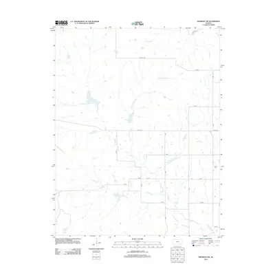
2012 Map of Piedmont SW
USGS Topo · Published 2012About this map
Elk River and its various tributaries define this corner of Elk County, showing a landscape shaped by the branching waters of the S Br Elk River, Rowe Br Elk River, and S Br Otter Cr. The geography is organized by a strictly defined grid of rural township roads and numbered routes, such as Twp Hwy 512 and Crisco Rd, which segment the terrain into agricultural parcels. This 2012 survey illustrates the modern layout of these thoroughfares, including the uniquely named Quail road. For local history and genealogy, the presence of the Forest Cem provides a specific point of interest for researchers tracing family ties to this rural Kansas prairie. The map captures the subtle drainage patterns where the river bends and meets smaller branches, reflecting the enduring rural character of the region.
Find a feature on this map
24 named features on this map. Tap any name to fly to it.
Don’t see what you’re looking for? This feature index may not catch every label — zoom into the map to look around manually.
Map Details
Editions of this 2012 Piedmont SW Map
This is the sole edition of this map. No revisions or reprints were ever made.
Other maps of this area

1885 · Eureka
USGS Topo · 1:125,000

1885 · Sedan
USGS Topo · 1:125,000

1888 · Eureka
USGS Topo · 1:125,000

1888 · Eldorado
USGS Topo · 1:125,000

1889 · Burden
USGS Topo · 1:125,000

1889 · Sedan
USGS Topo · 1:125,000

1894 · Eureka
USGS Topo · 1:125,000

1955 · Wichita
USGS Topo · 1:250,000

1958 · Wichita
USGS Topo · 1:250,000
1964 · Howard
USGS Topo · 1:24,000