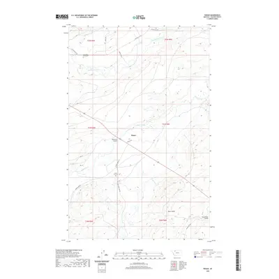
2020 Map of Piegan
USGS Topo · Published 2020About this map
Piegan serves as a central point in this landscape where the high plains meet the intricate drainage systems of Glacier County. The terrain is defined by dramatic erosion patterns, including Whitecalf Coulee, Kipps Coulee, and Rocky Ridge Coulee, which carve through the plateau toward the Two Medicine River and Badger Creek. These natural waterways are augmented by the Piegan Canal, reflecting the vital role of water management in this northern environment.
Find a feature on this map
23 named features on this map. Tap any name to fly to it.
Don’t see what you’re looking for? This feature index may not catch every label — zoom into the map to look around manually.
Map Details
Editions of this 2020 Piegan Map
This is the sole edition of this map. No revisions or reprints were ever made.
Other maps of this area

1911 · Blackfoot
USGS Topo · 1:125,000

1914 · Heart Butte
USGS Topo · 1:125,000

1918 · Heart Butte
USGS Topo · 1:125,000

1960 · Cut Bank
USGS Topo · 1:250,000

1963 · Cut Bank
USGS Topo · 1:250,000

1964 · Cut Bank
USGS Topo · 1:250,000
1968 · Piegan
USGS Topo · 1:24,000

1968 · White Man Coulee
USGS Topo · 1:24,000
1968 · Rocky Ridge
USGS Topo · 1:24,000
1968 · Mission Lake East
USGS Topo · 1:24,000