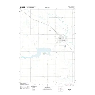
2011 Map of Pierce
USGS Topo · Published 2011About this map
Pierce serves as the central hub of this northeast Nebraska landscape, situated at the confluence of Willow Creek and the North Fork Elkhorn River. The town's layout is defined by its proximity to water, with Pierce Lake and the Pierce Dam anchoring the eastern edge near Gilman Park Campground. To the southwest, the expansive Willow Creek Lake dominates the terrain, illustrating the importance of water management and recreation in this agricultural region. Local institutions and community spaces are well-documented, including the Pierce County Fairgrounds, the Pierce Post Office, and the Pierce Community Golf Course. For those tracing local history or family roots, the map identifies significant burial sites such as Prospect View Cemetery and Saint Josephs Cemetery, alongside contemporary agricultural developments like Cuthills Vineyards west of the city center.
Find a feature on this map
37 named features on this map. Tap any name to fly to it.
Don’t see what you’re looking for? This feature index may not catch every label — zoom into the map to look around manually.
Map Details
Editions of this 2011 Pierce Map
This is the sole edition of this map. No revisions or reprints were ever made.
Other maps of this area

1955 · Sioux City
USGS Topo · 1:250,000

1958 · Sioux City
USGS Topo · 1:250,000

1959 · Sioux City
USGS Topo · 1:250,000

1963 · Pierce NW
USGS Topo · 1:24,000

1963 · Pierce SE
USGS Topo · 1:24,000

1963 · Foster
USGS Topo · 1:24,000

1963 · Meadow Grove
USGS Topo · 1:24,000

1963 · Norfolk
USGS Topo · 1:24,000

1963 · Osmond
USGS Topo · 1:24,000

1963 · Wee Town
USGS Topo · 1:24,000