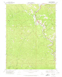
1969 Map of Piercy
USGS Topo · Published 1974About this map
The South Fork Eel River winds through the heart of this North Coast landscape, serving as the primary corridor for both travel and settlement. During the late 1960s, the village of Piercy and the nearby Andersonia represent the primary residential hubs, while the map preserves the location of Moody (Site), a former settlement now recorded as a historical location. The rugged topography is punctuated by family-named landmarks such as Metcalf Ranch and the solitary Lilley Grave, which offer specific points of interest for genealogists tracing local lineage.
Find a feature on this map
40 named features on this map. Tap any name to fly to it.
Don’t see what you’re looking for? This feature index may not catch every label — zoom into the map to look around manually.
Map Details
Editions of this 1969 Piercy Map
4 editions found
Other maps of this area

1920 · Cummings
USGS Topo · 1:62,500

1920 · Harris
USGS Topo · 1:62,500

1921 · Briceland
USGS Topo · 1:62,500

1949 · Alderpoint
USGS Topo · 1:62,500

1949 · Garberville
USGS Topo · 1:62,500

1950 · Piercy
USGS Topo · 1:62,500

1951 · Alderpoint
USGS Topo · 1:62,500

1951 · Garberville
USGS Topo · 1:62,500

1952 · Leggett
USGS Topo · 1:62,500

1957 · Ukiah
USGS Topo · 1:250,000