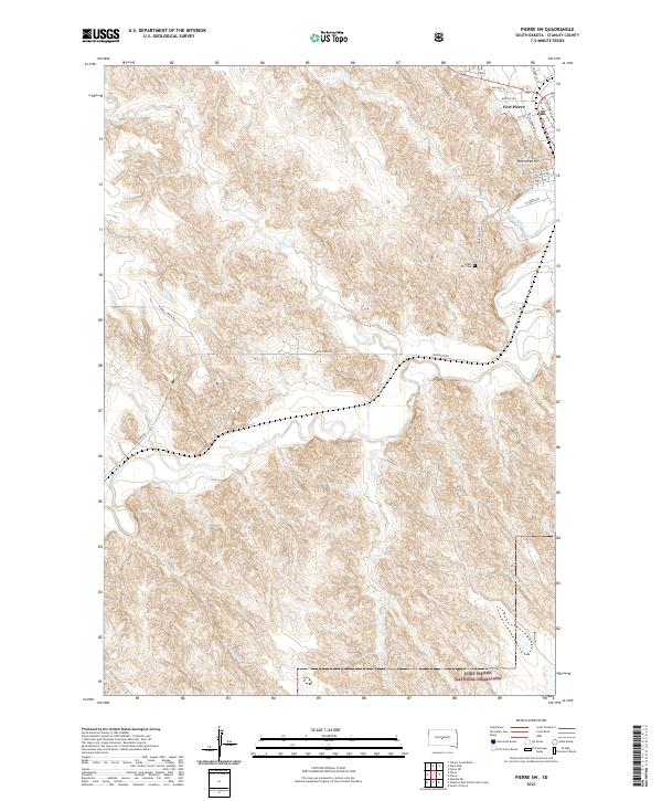
2021 Map of Pierre SW
USGS Topo · Published 2021About this map
Fort Pierre stands at the confluence of history and the high plains, situated where the Bad River meets the Missouri River corridor. This 2021 survey illustrates the city's residential expansion alongside significant historical landmarks such as Verendrye Hill, which commemorates early European exploration of the northern plains. The map details a transition from the urban grid of streets like W Main Ave and Yellowstone St to the expansive protected landscapes of the Fort Pierre National Grassland to the south. Numerous drainage systems including Willow Creek, Gray Blanket Creek, and Porcupine Creek carve through the local topography, indicating the importance of water management in this prairie environment. Genealogists and local historians can locate the Cedar Hill Cemetery and trace the winding paths of rural routes like Powell Creek Road.
Find a feature on this map
34 named features on this map. Tap any name to fly to it.
Don’t see what you’re looking for? This feature index may not catch every label — zoom into the map to look around manually.
Map Details
Editions of this 2021 Pierre SW Map
This is the sole edition of this map. No revisions or reprints were ever made.
Other maps of this area

1924 · Pierre
USGS Topo · 1:62,500

1937 · Oahe
USGS Topo · 1:62,500

1953 · Teton
USGS Topo · 1:24,000

1953 · Pierre SW
USGS Topo · 1:24,000

1953 · Wendte NE
USGS Topo · 1:24,000

1953 · Pierre 3 NW
USGS Topo · 1:24,000

1954 · Pierre
USGS Topo · 1:250,000

1958 · Pierre
USGS Topo · 1:250,000

1967 · Pierre NE
USGS Topo · 1:24,000
1972 · Pierre 3 NE
USGS Topo · 1:24,000