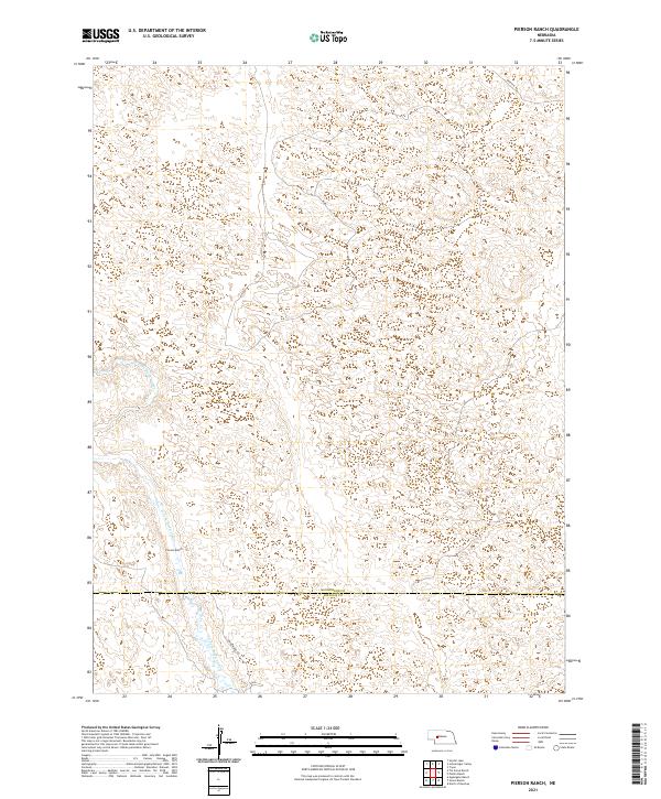
2021 Map of Pierson Ranch
USGS Topo · Published 2021About this map
N Fork Birdwood Cr carves a path through the high Sandhills of the Nebraska interior, defining the primary drainage for this portion of the rural landscape. The map centers on the namesake Pierson Ranch, a significant landmark in a region characterized by expansive rangeland and the complex topography of stabilized dunes. Straddling the boundary between McPherson Co and Lincoln Co, the area is sparsely settled, with transportation limited to routes like Griffith Rd and N Birdwood Rd. This survey documents the environmental character of the central flyway region, showing the intricate network of depressions and ridges that shape local cattle ranching operations and water management in the early twenty-first century.
Find a feature on this map
11 named features on this map. Tap any name to fly to it.
Don’t see what you’re looking for? This feature index may not catch every label — zoom into the map to look around manually.
Map Details
Editions of this 2021 Pierson Ranch Map
This is the sole edition of this map. No revisions or reprints were ever made.
Other maps of this area

1898 · Paxton
USGS Topo · 1:125,000

1899 · North Platte
USGS Topo · 1:125,000

1901 · Paxton
USGS Topo · 1:125,000

1902 · North Platte
USGS Topo · 1:125,000

1949 · Wright Valley
USGS Topo · 1:62,500

1951 · Tryon
USGS Topo · 1:62,500

1951 · Wright Valley
USGS Topo · 1:62,500

1954 · North Platte
USGS Topo · 1:250,000

1956 · North Platte
USGS Topo · 1:250,000

1957 · North Platte
USGS Topo · 1:250,000