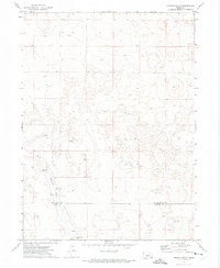
1972 Map of Pierson Ranch
USGS Topo · Published 1975About this map
North Fork Birdwood Creek flows through the southern half of this Sandhills landscape, marking a vital water source in an area defined by large-scale cattle ranching. The 1972 topography reveals the sparse settlement patterns of the Nebraska interior, where family-run operations like Pierson Ranch and the Brown Brothers Ranch anchor the local geography. Several unnamed Springs and individual Spring points dot the drainages, indicating the critical role of groundwater in sustaining the region's livestock economy. The map also delineates the boundary between Mc Pherson Co and Lincoln Co, providing a clear record of land division and property lines in this rural corridor during the early 1970s.
Find a feature on this map
6 named features on this map. Tap any name to fly to it.
Don’t see what you’re looking for? This feature index may not catch every label — zoom into the map to look around manually.
Map Details
Editions of this 1972 Pierson Ranch Map
This is the sole edition of this map. No revisions or reprints were ever made.
Other maps of this area

1898 · Paxton
USGS Topo · 1:125,000

1899 · North Platte
USGS Topo · 1:125,000

1901 · Paxton
USGS Topo · 1:125,000

1902 · North Platte
USGS Topo · 1:125,000

1949 · Wright Valley
USGS Topo · 1:62,500

1951 · Tryon
USGS Topo · 1:62,500

1951 · Wright Valley
USGS Topo · 1:62,500

1954 · North Platte
USGS Topo · 1:250,000

1956 · North Platte
USGS Topo · 1:250,000

1957 · North Platte
USGS Topo · 1:250,000