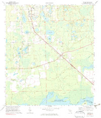
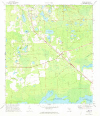
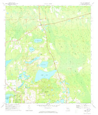
1970 Map of Pierson
USGS Topo · Published 1983About this map
The town of Pierson and its agricultural surroundings are depicted during the 1970s, a landscape defined by numerous lakes and the citrus-growing culture of northern Volusia County. The Seaboard Coast Line railroad runs diagonally through the territory, connecting the settlements of Emporia and Barberville. Local infrastructure for the era is evident through landmarks like Taylor High Sch, Swanson Field, and a north-south Landing Strip near the town center.
Find a feature on this map
27 named features on this map. Tap any name to fly to it.
Don’t see what you’re looking for? This feature index may not catch every label — zoom into the map to look around manually.
Map Details
Editions of this 1970 Pierson Map
2 editions found
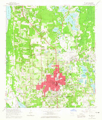
Other maps of this area

1954 · Daytona Beach
USGS Topo · 1:250,000

1958 · Daytona Beach
USGS Topo · 1:250,000

1962 · Lake Woodruff
USGS Topo · 1:24,000

1964 · Daytona Beach
USGS Topo · 1:250,000
1964 · De Land
USGS Topo · 1:24,000
1970 · Welaka SE
USGS Topo · 1:24,000
1970 · Seville
USGS Topo · 1:24,000
1970 · Pierson
USGS Topo · 1:24,000
1971 · Lake Dias
USGS Topo · 1:24,000
1972 · Astor
USGS Topo · 1:24,000