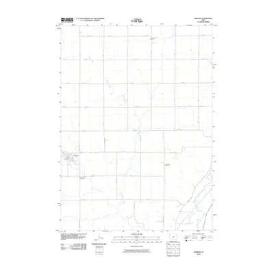
2010 Map of Pierson
USGS Topo · Published 2010About this map
Pierson serves as the primary hub of this eastern Woodbury County landscape, situated near the western edge of the map. The settlement’s civic center is marked by the Pierson Post Office, while its social history is anchored by three distinct burial grounds: Grand Meadow Cemetery, Good Hope Cemetery, and Greenwood Cemetery, which are distributed across the rural sections to the north and east.
Find a feature on this map
31 named features on this map. Tap any name to fly to it.
Don’t see what you’re looking for? This feature index may not catch every label — zoom into the map to look around manually.
Map Details
Editions of this 2010 Pierson Map
This is the sole edition of this map. No revisions or reprints were ever made.
Other maps of this area

1954 · Fort Dodge
USGS Topo · 1:250,000

1957 · Fort Dodge
USGS Topo · 1:250,000

1958 · Fort Dodge
USGS Topo · 1:250,000

1969 · Pierson
USGS Topo · 1:24,000

1969 · Correctionville NW
USGS Topo · 1:24,000

1969 · Fielding
USGS Topo · 1:24,000

1969 · Correctionville
USGS Topo · 1:24,000
1969 · Kingsley
USGS Topo · 1:24,000

1969 · Cushing
USGS Topo · 1:24,000
1969 · Kingsley NW
USGS Topo · 1:24,000