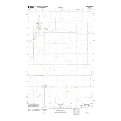
2010 Map of Pierz
USGS Topo · Published 2010About this map
Pierz and Buckman anchor this central Minnesota landscape, where the agricultural grid is interrupted by the meandering course of the Skunk River. This 2010 survey highlights the transformation of the region's infrastructure, most notably with the Soo Line Trl following the historic railroad corridor across the terrain. Small-town hubs are clearly defined, featuring localized landmarks such as the Pierz Post Office and the Buckman Post Office. To the north, the Skunk River Dam regulates the water as it flows near Granite Lake, while the local social fabric is represented by Saint Joseph's Catholic Cemetery and Saint Michael's Cemetery. The geography is further defined by a complex network of tributaries, including Hillman Creek, Skunk Creek, and Buckman Creek, which traverse the farming parcels and connect the communities of Pierz and Genola.
Find a feature on this map
43 named features on this map. Tap any name to fly to it.
Don’t see what you’re looking for? This feature index may not catch every label — zoom into the map to look around manually.
Map Details
Editions of this 2010 Pierz Map
This is the sole edition of this map. No revisions or reprints were ever made.
Other maps of this area

1948 · Pierz
USGS Topo · 1:62,500

1948 · Lastrup
USGS Topo · 1:62,500

1950 · Lastrup
USGS Topo · 1:62,500

1950 · Pierz
USGS Topo · 1:62,500

1953 · Duluth
USGS Topo · 1:250,000

1953 · Brainerd
USGS Topo · 1:250,000

1953 · Saint Cloud
USGS Topo · 1:250,000

1953 · Stillwater
USGS Topo · 1:250,000

1955 · Stillwater
USGS Topo · 1:250,000

1957 · Brainerd
USGS Topo · 1:250,000