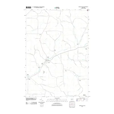
2010 Map of Pigeon Falls
USGS Topo · Published 2010About this map
Pigeon Falls serves as the primary hub of this Trempealeau County landscape, where the waters of Pigeon Creek converge near the Evangelical Cemetery. The surrounding terrain is defined by a dense network of coulees, including Tomter Coulee, Hegge Coulee, and Steig Coulee, reflecting the unique unglaciated topography of western Wisconsin. These narrow valleys dictate the path of local travel, with rural routes like Steig Coulee Rd following the natural contours of the land.
Find a feature on this map
65 named features on this map. Tap any name to fly to it.
Don’t see what you’re looking for? This feature index may not catch every label — zoom into the map to look around manually.
Map Details
Editions of this 2010 Pigeon Falls Map
This is the sole edition of this map. No revisions or reprints were ever made.
Other maps of this area

1926 · Whitehall
USGS Topo · 1:62,500

1927 · Blair
USGS Topo · 1:62,500

1927 · Strum
USGS Topo · 1:62,500

1929 · Whitehall
USGS Topo · 1:62,500

1930 · Strum
USGS Topo · 1:62,500

1935 · Osseo
USGS Topo · 1:48,000

1940 · Osseo
USGS Topo · 1:62,500

1953 · Eau Claire
USGS Topo · 1:250,000

1958 · Eau Claire
USGS Topo · 1:250,000

1964 · Eau Claire
USGS Topo · 1:250,000