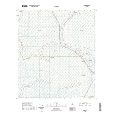
2020 Map of Pigeon
USGS Topo · Published 2020About this map
The Atchafalaya Basin Floodway dominates this watery landscape of Iberville Parish, where the settlement of Pigeon sits along the banks of the Lower Grand River. This 2020 survey reveals the complex drainage network of south Louisiana, featuring numerous named waterways such as Bayou Teche, Big Bayou Pigeon, and Bayou Postillion. The eastern edge of the quadrangle is defined by the critical transit corridor of the Intracoastal Waterway, leading down to the Gulf Intracoastal Waterway in the southern reaches. Small clusters of development at Choctaw and Pumpkin Point are linked by local routes like Bayou Pigeon Rd and La 997. The map illustrates how human habitation is concentrated on the high ground of the natural levees, surrounded by a labyrinth of swamps and bayous that cross parish lines into St. Martin, Iberia, and Assumption.
Find a feature on this map
31 named features on this map. Tap any name to fly to it.
Don’t see what you’re looking for? This feature index may not catch every label — zoom into the map to look around manually.
Map Details
Editions of this 2020 Pigeon Map
This is the sole edition of this map. No revisions or reprints were ever made.
Other maps of this area

1935 · Chicot Lake
USGS Topo · 1:62,500

1936 · White Castle
USGS Topo · 1:62,500

1945 · New Orleans
USGS Topo · 1:250,000

1948 · Foster
USGS Topo · 1:62,500

1953 · Napoleonville
USGS Topo · 1:62,500

1953 · Crescent
USGS Topo · 1:24,000

1953 · Pigeon Bay
USGS Topo · 1:24,000
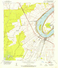
1953 · White Castle
USGS Topo · 1:24,000

1954 · Chicot Lake
USGS Topo · 1:62,500

1954 · Baton Rouge
USGS Topo · 1:250,000