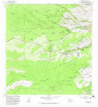
1981 Map of Piihonua
USGS Topo · Published 1983About this map
The Wailuku River carves a dramatic path through this 1981 survey, featuring iconic landmarks like the Boiling Pots and numerous cataracts such as Pepee Falls and Pakaluahine Falls. The landscape is fundamentally defined by volcanic history, with the massive Lava Flow of 1855 and Lava Flow of 1881 clearly delineated as they descend toward the coast. These geological formations dictate the placement of human settlements and the extensive system of Punahoa Homesteads and Kaumana Homesteads that hug the lower slopes.
Find a feature on this map
62 named features on this map. Tap any name to fly to it.
Don’t see what you’re looking for? This feature index may not catch every label — zoom into the map to look around manually.
Map Details
Editions of this 1981 Piihonua Map
2 editions found
Other maps of this area

1915 · Honomu
USGS Topo · 1:62,500

1917 · Hilo
USGS Topo · 1:62,500

1930 · Humuula
USGS Topo · 1:62,500

1932 · Hilo
USGS Topo · 1:62,500

1954 · Hawaii North
USGS Topo · 1:250,000

1956 · Pua Akala
USGS Topo · 1:24,000

1956 · Upper Piihonua
USGS Topo · 1:24,000
1956 · Kulani
USGS Topo · 1:24,000

1959 · Hawaii North
USGS Topo · 1:250,000

1961 · Hawaii North
USGS Topo · 1:250,000