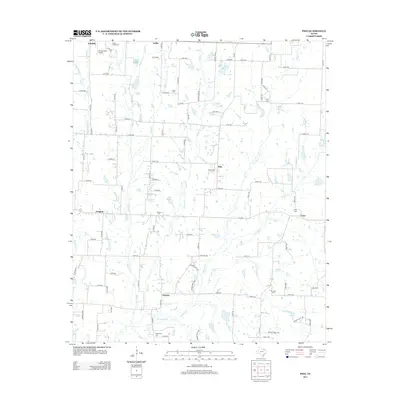
2013 Map of Pike
USGS Topo · Published 2013About this map
Pike and the surrounding rural landscape of Fannin County are defined by a complex network of creeks that once shaped the settlement of this north Texas region. Small communities such as Nobility, Delba, and Frognot are connected by a grid of county roads, punctuated by ancestral burial grounds like Indian Creek Cem and Fuller Cem. The map reveals a land heavily utilized for agriculture, where drainage is managed through countless unnamed farm ponds and major watercourses like Indian Creek and Bear Cr. To the south, Arnold and the neighborhood of Lane sit near the confluence of Arnold Cr and Elm Cr. Notable landmarks such as Rockys Place Airport highlight the modern transition of the landscape, while the numerous family-named cemeteries, including Du Laney Cem and Bethlehem Cem, provide critical points of reference for genealogists tracing early families in the area.
Find a feature on this map
106 named features on this map. Tap any name to fly to it.
Don’t see what you’re looking for? This feature index may not catch every label — zoom into the map to look around manually.
Map Details
Editions of this 2013 Pike Map
This is the sole edition of this map. No revisions or reprints were ever made.
Other maps of this area

1930 · Farmersville
USGS Topo · 1:62,500

1954 · Sherman
USGS Topo · 1:250,000

1958 · Sherman
USGS Topo · 1:250,000

1960 · Blue Ridge
USGS Topo · 1:24,000

1960 · Pike
USGS Topo · 1:24,000

1960 · Culleoka
USGS Topo · 1:24,000

1962 · Greenville NW
USGS Topo · 1:24,000

1962 · Farmersville
USGS Topo · 1:24,000

1964 · Trenton
USGS Topo · 1:24,000
1964 · Pilot Grove
USGS Topo · 1:24,000