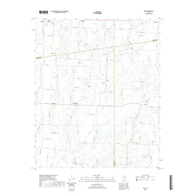
2019 Map of Pike
USGS Topo · Published 2019About this map
The rolling agricultural lands where Fannin, Collin, and Hunt counties meet are defined by small rural communities and family-named cemeteries. This 2019 survey documents the landscape surrounding Pike, Frognot, and Blue Ridge, revealing a pattern of settlement tied to the branching tributaries of Arnold Cr and Indian Cr. The map highlights several small aviation nodes, including Rockys Place Airport and Claassen Airport, which sit amidst a grid of county roads. Genealogists will find particular value in the clearly marked burial grounds such as Fuller Cem, Lee Cem, and Du Laney Cem, which anchor the history of these North Texas hamlets. The drainage patterns of Pot Rack Cr and Little Indian Cr illustrate how the terrain transitions between these small farming centers.
Find a feature on this map
100 named features on this map. Tap any name to fly to it.
Don’t see what you’re looking for? This feature index may not catch every label — zoom into the map to look around manually.
Map Details
Editions of this 2019 Pike Map
This is the sole edition of this map. No revisions or reprints were ever made.
Other maps of this area

1930 · Farmersville
USGS Topo · 1:62,500

1954 · Sherman
USGS Topo · 1:250,000

1958 · Sherman
USGS Topo · 1:250,000

1960 · Blue Ridge
USGS Topo · 1:24,000

1960 · Pike
USGS Topo · 1:24,000

1960 · Culleoka
USGS Topo · 1:24,000

1962 · Greenville NW
USGS Topo · 1:24,000

1962 · Farmersville
USGS Topo · 1:24,000

1964 · Trenton
USGS Topo · 1:24,000
1964 · Pilot Grove
USGS Topo · 1:24,000