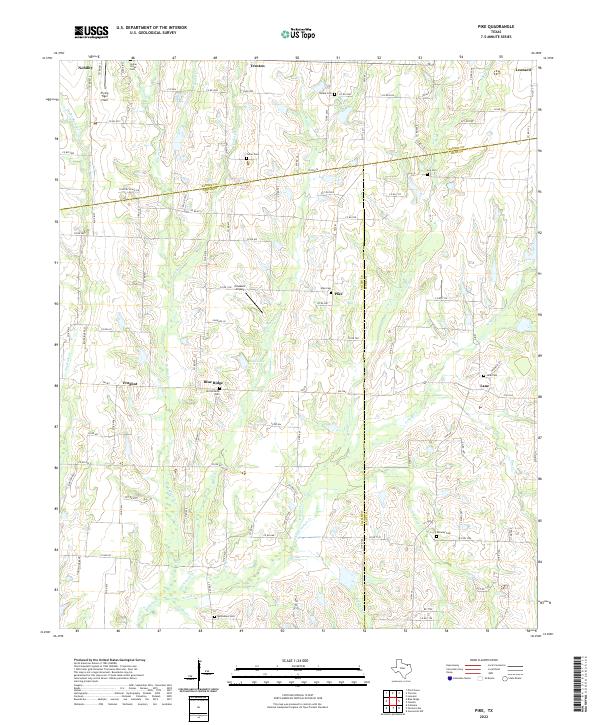
2022 Map of Pike
USGS Topo · Published 2022About this map
Pike and Frognot anchor this landscape along the tri-county intersection of Fannin, Collin, and Hunt counties. The terrain is defined by a dense network of seasonal and perennial watercourses, including Indian Creek, Lee Creek, and Elm Creek, which carve through the blackland prairies of North Texas. For family historians, the area is rich with rural burial sites like Indian Creek Cemetery and Old Richards Cemetery, documenting generations of settlement in this agricultural corridor. While predominantly rural, the presence of Flying Tiger Field and Claassen Airport indicates a reliance on small-craft aviation in a region otherwise linked by Farm-to-Market roads and county lines. Local hydrology is centered around Reed Lake and the branching forks of Arnold Creek, illustrating the drainage patterns that have shaped the local farming economy for over a century.
Find a feature on this map
113 named features on this map. Tap any name to fly to it.
Don’t see what you’re looking for? This feature index may not catch every label — zoom into the map to look around manually.
Map Details
Editions of this 2022 Pike Map
This is the sole edition of this map. No revisions or reprints were ever made.
Other maps of this area

1930 · Farmersville
USGS Topo · 1:62,500

1954 · Sherman
USGS Topo · 1:250,000

1958 · Sherman
USGS Topo · 1:250,000

1960 · Blue Ridge
USGS Topo · 1:24,000

1960 · Pike
USGS Topo · 1:24,000

1960 · Culleoka
USGS Topo · 1:24,000

1962 · Greenville NW
USGS Topo · 1:24,000

1962 · Farmersville
USGS Topo · 1:24,000

1964 · Trenton
USGS Topo · 1:24,000
1964 · Pilot Grove
USGS Topo · 1:24,000