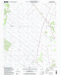
1997 Map of Pike Road
USGS Topo · Published 2001About this map
East Dismal Swamp dominates this coastal plain landscape, where the land-use patterns are defined by a sophisticated network of drainage improvements. This late-century update of earlier topographic data reveals how human engineering has shaped the border between Washington and Beaufort counties. A series of numbered and named waterways, including No 3 Canal, No 2 Canal, and the Intercepting Canal, cut straight lines across the swampy terrain to manage the flow toward the Pungo River.
Find a feature on this map
19 named features on this map. Tap any name to fly to it.
Don’t see what you’re looking for? This feature index may not catch every label — zoom into the map to look around manually.
Map Details
Editions of this 1997 Pike Road Map
This is the sole edition of this map. No revisions or reprints were ever made.
Other maps of this area

1914 · Belhaven
USGS Topo · 1:48,000

1916 · Belhaven
USGS Topo · 1:62,500

1943 · Plymouth
USGS Topo · 1:125,000

1950 · Pinetown
USGS Topo · 1:24,000

1951 · Belhaven
USGS Topo · 1:24,000

1951 · Pantego
USGS Topo · 1:24,000

1953 · Rocky Mount
USGS Topo · 1:250,000

1954 · Rocky Mount
USGS Topo · 1:250,000

1954 · Plymouth East
USGS Topo · 1:24,000

1954 · Roper South
USGS Topo · 1:24,000