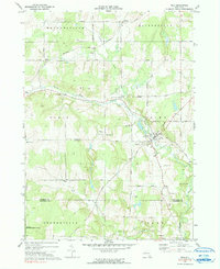
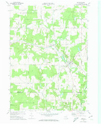
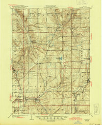
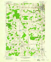
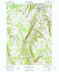
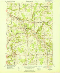
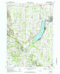
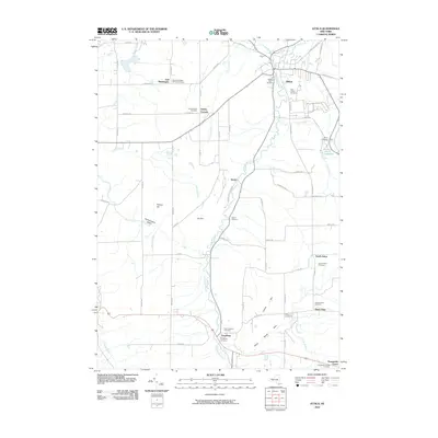
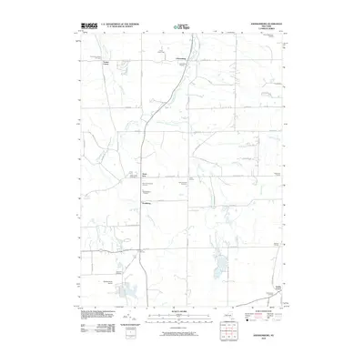
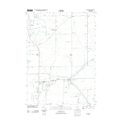
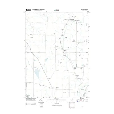
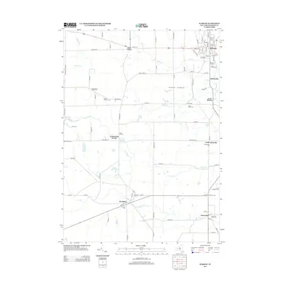
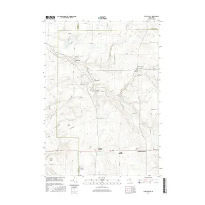
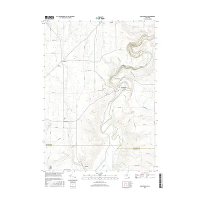
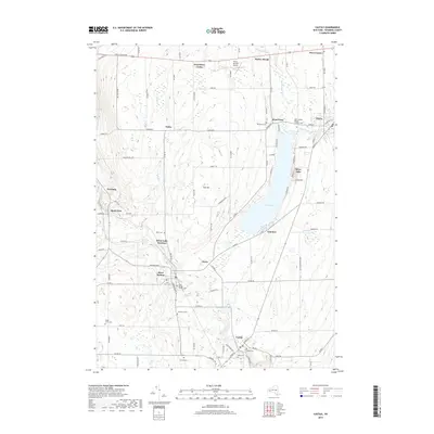
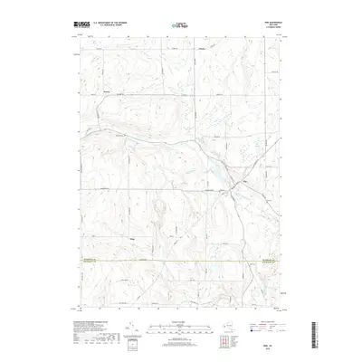
1972 Map of Pike
USGS Topo · Published 1990About this map
The valley of Wiscoy Creek anchors this rural landscape, which includes the village of Pike and the crossroads at Bliss. The settlement pattern reflects the area's agricultural and social foundations, featuring the County Fairgrounds east of the main village and several family-named burial sites like Lyonsburg Cem and Alger Cem. To the north, small hamlets such as Hardys and Howes are connected by a network of local roads including Hobday Road and Baltimore Road.
Find a feature on this map
43 named features on this map. Tap any name to fly to it.
Don’t see what you’re looking for? This feature index may not catch every label — zoom into the map to look around manually.
Map Details
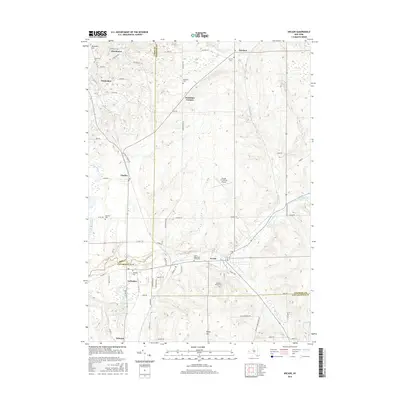
Editions of this 1972 Pike Map
2 editions found
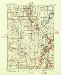
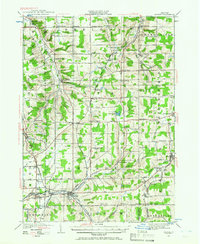
Historical Maps of Hume Through Time
68 maps found
1905 Portage
Wyoming County, NY
1923 Arcade
Wyoming County, NY
1925 Arcade
Wyoming County, NY
1943 Castile
Wyoming County, NY
1943 Pike
Wyoming County, NY
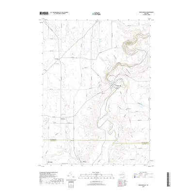
1943 Portageville
Wyoming County, NY
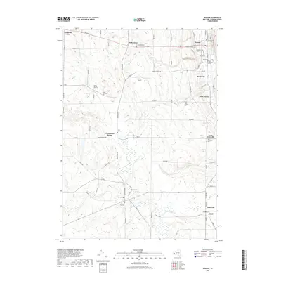
1943 Warsaw
Wyoming County, NY
1944 Castile
Wyoming County, NY
1944 Pike
Wyoming County, NY
1944 Portageville
Wyoming County, NY

1944 Warsaw
Wyoming County, NY
1949 Attica
Wyoming County, NY
1949 Cowlesville
Wyoming County, NY
1949 Dale
Wyoming County, NY
1951 Attica
Wyoming County, NY
1951 Cowlesville
Wyoming County, NY
1951 Dale
Wyoming County, NY
1966 Arcade
Wyoming County, NY
1966 Johnsonburg
Wyoming County, NY
1972 Castile
Wyoming County, NY
1972 Pike
Wyoming County, NY
1972 Portageville
Wyoming County, NY
1972 Warsaw
Wyoming County, NY
2010 Arcade
Wyoming County, NY
2010 Attica
Wyoming County, NY
2010 Castile
Wyoming County, NY
2010 Cowlesville
Wyoming County, NY
2010 Dale
Wyoming County, NY
2010 Johnsonburg
Wyoming County, NY
2010 Pike
Wyoming County, NY
2010 Portageville
Wyoming County, NY
2010 Warsaw
Wyoming County, NY
2013 Arcade
Wyoming County, NY
2013 Attica
Wyoming County, NY
2013 Castile
Wyoming County, NY
2013 Cowlesville
Wyoming County, NY
2013 Dale
Wyoming County, NY
2013 Johnsonburg
Wyoming County, NY
2013 Pike
Wyoming County, NY
2013 Portageville
Wyoming County, NY
2013 Warsaw
Wyoming County, NY
2016 Arcade
Wyoming County, NY
2016 Attica
Wyoming County, NY
2016 Castile
Wyoming County, NY
2016 Cowlesville
Wyoming County, NY
2016 Dale
Wyoming County, NY
2016 Johnsonburg
Wyoming County, NY
2016 Pike
Wyoming County, NY
2016 Portageville
Wyoming County, NY
2016 Warsaw
Wyoming County, NY
2019 Arcade
Wyoming County, NY
2019 Attica
Wyoming County, NY
2019 Castile
Wyoming County, NY
2019 Cowlesville
Wyoming County, NY
2019 Dale
Wyoming County, NY
2019 Johnsonburg
Wyoming County, NY
2019 Pike
Wyoming County, NY
2019 Portageville
Wyoming County, NY
2019 Warsaw
Wyoming County, NY

2023 Arcade
Wyoming County, NY

2023 Attica
Wyoming County, NY

2023 Castile
Wyoming County, NY

2023 Cowlesville
Wyoming County, NY

2023 Dale
Wyoming County, NY

2023 Johnsonburg
Wyoming County, NY

2023 Pike
Wyoming County, NY

2023 Portageville
Wyoming County, NY

2023 Warsaw
Wyoming County, NY