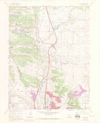
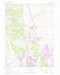
1961 Map of Pikeview
USGS Topo · Published 1970About this map
The United States Air Force Academy grounds dominate the northern half of this landscape, featuring the Douglas Valley housing area and the Air Force Academy High Sch Jr High Sch. This 1961 edition, updated with 1969 revisions, documents the rapid southern expansion of Colorado Springs as residential and industrial development encroaches upon the high plains and rocky bluffs. The rail corridor remains a vital artery, with both the Denver and Rio Grande Western RR and the Atchison Topeka and Santa Fe RR flanking Monument Creek.
Find a feature on this map
55 named features on this map. Tap any name to fly to it.
Don’t see what you’re looking for? This feature index may not catch every label — zoom into the map to look around manually.
Map Details
Editions of this 1961 Pikeview Map
5 editions found
Other maps of this area

1893 · Colorado Springs
USGS Topo · 1:125,000

1894 · Castle Rock
USGS Topo · 1:125,000

1909 · Colorado Springs
USGS Topo · 1:125,000

1913 · Castle Rock
USGS Topo · 1:125,000

1940 · Elbert
USGS Topo · 1:62,500

1942 · Colorado Springs
USGS Topo · 1:125,000

1944 · Elbert
USGS Topo · 1:62,500

1948 · Manitou Springs
USGS Topo · 1:24,000

1948 · Colorado Springs
USGS Topo · 1:62,500

1948 · Pikeview
USGS Topo · 1:24,000
Featured Places
- Colorado Springs, CO
- Pikeview, Colorado Springs
- Papeton, Colorado Springs
- El Paso County, CO
- United States