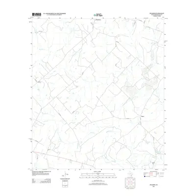
2013 Map of Pilgrim
USGS Topo · Published 2013About this map
Wrightsboro and the settlement of Pilgrim anchor this rural landscape in Gonzales County, defined by a dense network of seasonal and perennial waterways. The southern portion of the map is characterized by a series of distinct water bodies, including Pilgrim Lake, Horseshoe Lake, and Seeny Lake, which lie near the winding path of Sandies Creek. This hydrology suggests a low-lying floodplain area where water naturally pools, creating landmarks like Claybottom Lake.
Find a feature on this map
36 named features on this map. Tap any name to fly to it.
Don’t see what you’re looking for? This feature index may not catch every label — zoom into the map to look around manually.
Map Details
Editions of this 2013 Pilgrim Map
This is the sole edition of this map. No revisions or reprints were ever made.
Other maps of this area

1920 · Smiley
USGS Topo · 1:125,000

1953 · Seguin
USGS Topo · 1:250,000

1958 · Seguin
USGS Topo · 1:250,000

1959 · Cost
USGS Topo · 1:24,000

1959 · Gonzales South
USGS Topo · 1:24,000

1960 · Cheapside
USGS Topo · 1:24,000

1960 · Westhoff
USGS Topo · 1:24,000

1961 · Sample
USGS Topo · 1:24,000
1961 · Pilgrim
USGS Topo · 1:24,000
1962 · Smiley
USGS Topo · 1:24,000