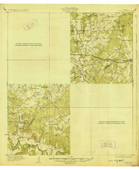
1959 Map of Gonzales South
USGS Topo · Published 1960About this map
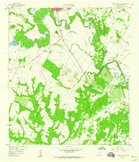
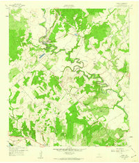
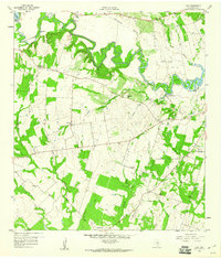
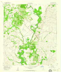
The confluence of the San Marcos River and the Guadalupe River dominates this mid-century landscape south of Gonzales. The map captures the transitional character of the Texas post-war era, where agricultural land meets emerging infrastructure like the Pipeline corridors and a Drive-in Theater along the highway. Settlement patterns are sparse, represented by Santa Anna and Summerville, while the local topography is defined by significant water features such as Wood Lake (H-5 Lake) and Stahl Lake. Genealogy researchers will find significant value in the documentation of family-named burial grounds, including the De Witt Cem, Guadalupe Cem, and Terrysville Cem. The presence of several Gravel Pits and a Clay Pit indicates the importance of local mineral extraction to the economy of the county at this time.
Find a feature on this map
31 named features on this map. Tap any name to fly to it.
Don’t see what you’re looking for? This feature index may not catch every label — zoom into the map to look around manually.
Map Details
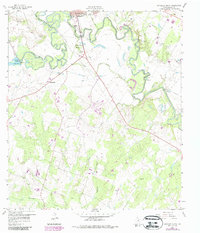
Editions of this 1959 Gonzales South Map
3 editions found

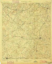
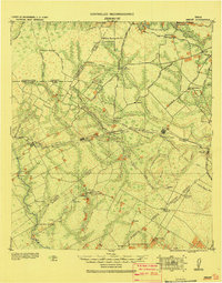
Other maps of this area
1901 · Flatonia
USGS Topo · 1:125,000

1911 · San Marcos
USGS Topo · 1:125,000

1919 · San Marcos
USGS Topo · 1:125,000
1920 · Smiley
USGS Topo · 1:125,000
1929 · Luling
USGS Topo · 1:62,500

1953 · Seguin
USGS Topo · 1:250,000

1958 · Seguin
USGS Topo · 1:250,000
1959 · Ottine
USGS Topo · 1:24,000
1959 · Cost
USGS Topo · 1:24,000
1959 · Hochheim
USGS Topo · 1:24,000