
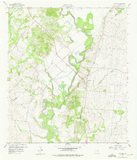
1959 Map of Hochheim
USGS Topo · Published 1960About this map
The Guadalupe River carves a winding path through this region of DeWitt and Gonzales Counties, shaping a landscape defined by its fertile bottoms and upland gravel deposits. The settlement of Hochheim serves as a central point, situated near a network of rural roads that connect small communities like Dreyer and Steen. For those tracing family history, the map identifies local spiritual and commemorative sites including Ebenezer Ch, Guadalupe Ch, and Mt Nebo Ch, alongside the Guadalupe Cem. The economy of the late 1950s is evidenced by several Gravel Pits and an Artesian Well, reflecting the area's reliance on its natural resources. The erratic oxbows of the river, particularly around Turkey Bottom, illustrate the active hydrology that has influenced land use and property lines along the indefinite boundary between the two counties.
Find a feature on this map
20 named features on this map. Tap any name to fly to it.
Don’t see what you’re looking for? This feature index may not catch every label — zoom into the map to look around manually.
Map Details
Editions of this 1959 Hochheim Map
3 editions found
Other maps of this area

1953 · Seguin
USGS Topo · 1:250,000

1958 · Seguin
USGS Topo · 1:250,000

1959 · Gonzales South
USGS Topo · 1:24,000

1959 · Hamon
USGS Topo · 1:24,000

1960 · Concrete
USGS Topo · 1:24,000

1960 · Cheapside
USGS Topo · 1:24,000

1960 · Westhoff
USGS Topo · 1:24,000

1962 · Edgar
USGS Topo · 1:24,000

1963 · Yoakum
USGS Topo · 1:24,000
1965 · Shiner
USGS Topo · 1:24,000