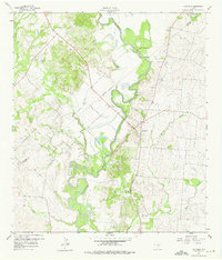
1959 Map of Hochheim
USGS Topo · Published 1975About this map
The Guadalupe River carves a winding path through the borderlands of Gonzales and De Witt counties, its complex oxbows defining the local landscape in the late 1950s. This survey captures a rural Texas economy transitioning between traditional agriculture and industrial resource extraction. The community of Hochheim serves as a central anchor, situated just west of extensive Gravel Pits and the Mt Nebo Ch. Smaller, potentially ephemeral settlements like Steen and Dreyer are documented alongside family-named landmarks such as Turkey Bottom and McCoy Creek. The map provides specific detail for genealogists and local historians, noting isolated infrastructure like a Pipeline, an Artesian Well, and the Guadalupe Ch, reflecting the dispersed nature of settlement along the river valley and the undulating terrain of the surrounding ranch land.
Find a feature on this map
23 named features on this map. Tap any name to fly to it.
Don’t see what you’re looking for? This feature index may not catch every label — zoom into the map to look around manually.
Map Details
Editions of this 1959 Hochheim Map
3 editions found
Other maps of this area

1953 · Seguin
USGS Topo · 1:250,000

1958 · Seguin
USGS Topo · 1:250,000

1959 · Hochheim
USGS Topo · 1:24,000

1959 · Gonzales South
USGS Topo · 1:24,000

1959 · Hamon
USGS Topo · 1:24,000

1960 · Concrete
USGS Topo · 1:24,000

1960 · Cheapside
USGS Topo · 1:24,000

1960 · Westhoff
USGS Topo · 1:24,000

1962 · Edgar
USGS Topo · 1:24,000

1963 · Yoakum
USGS Topo · 1:24,000