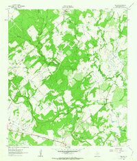
1961 Map of Pilgrim
USGS Topo · Published 1963About this map
Sandies Creek and its many tributaries, including Salty Creek and Buckhorn Creek, define the drainage patterns of this Gonzales County landscape in the early 1960s. The small settlement of Pilgrim serves as a local focal point near the Pilgrim Ch, while the community of Wrightsboro occupies the northern portion of the map. This area shows a transition from agricultural fields to wooded creek bottoms, with a network of unimproved roads and fence lines marking property boundaries.
Find a feature on this map
23 named features on this map. Tap any name to fly to it.
Don’t see what you’re looking for? This feature index may not catch every label — zoom into the map to look around manually.
Map Details
Editions of this 1961 Pilgrim Map
2 editions found
Other maps of this area

1920 · Smiley
USGS Topo · 1:125,000

1953 · Seguin
USGS Topo · 1:250,000

1958 · Seguin
USGS Topo · 1:250,000

1959 · Cost
USGS Topo · 1:24,000

1959 · Gonzales South
USGS Topo · 1:24,000

1960 · Cheapside
USGS Topo · 1:24,000

1960 · Westhoff
USGS Topo · 1:24,000

1961 · Sample
USGS Topo · 1:24,000
1962 · Smiley
USGS Topo · 1:24,000
1962 · Leesville
USGS Topo · 1:24,000