
1916 Map of Pillager
USGS Topo · Published 1957About this map
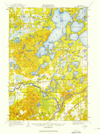
Mississippi River and Gull River converge in this northern landscape, forming a complex network of waterways during a period of expanding recreational and industrial development. The massive expanse of Gull Lake dominates the central terrain, regulated by the Gull Lake Dam and featuring early seasonal landmarks like Grand View Lodge. A heavy concentration of rural schoolhouses, including the Home Brook School, Van Sickel School, and Snow School, reflects the distributed settlement pattern of the early twentieth century across Rail Prairie and Home Brook townships.
Find a feature on this map
60 named features on this map. Tap any name to fly to it.
Don’t see what you’re looking for? This feature index may not catch every label — zoom into the map to look around manually.
Map Details
Editions of this 1916 Pillager Map
2 editions found
Other maps of this area

1915 · Brainerd
USGS Topo · 1:62,500

1918 · Brainerd
USGS Topo · 1:62,500

1919 · Pillager
USGS Topo · 1:62,500

1919 · Leader
USGS Topo · 1:62,500

1948 · Belle Prairie
USGS Topo · 1:62,500

1948 · Lastrup
USGS Topo · 1:62,500

1948 · Cushing
USGS Topo · 1:62,500

1950 · Lastrup
USGS Topo · 1:62,500

1950 · Belle Prairie
USGS Topo · 1:62,500

1950 · Cushing
USGS Topo · 1:62,500