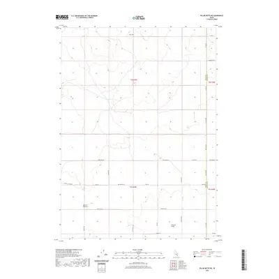
2020 Map of Pillar Butte NE
USGS Topo · Published 2020About this map
Flat Top dominates the northern landscape of this Bingham County terrain, marking a high point in a region defined by subtle volcanic and desert features. The southeastern portion of the quadrangle opens into Pleasant Valley, a relatively level expanse transitioned by a network of rural corridors including Schritter Rd and Dyer Rd. The presence of Winters Blowout suggests the wind-scoured nature of the Idaho high desert, where geologic depressions and ridges dictate the placement of human infrastructure.
Find a feature on this map
25 named features on this map. Tap any name to fly to it.
Don’t see what you’re looking for? This feature index may not catch every label — zoom into the map to look around manually.
Map Details
Editions of this 2020 Pillar Butte NE Map
This is the sole edition of this map. No revisions or reprints were ever made.
Other maps of this area

1934 · American Falls
USGS Topo · 1:62,500

1936 · American Falls
USGS Topo · 1:62,500

1954 · Pocatello
USGS Topo · 1:250,000

1955 · Idaho Falls
USGS Topo · 1:250,000

1958 · Idaho Falls
USGS Topo · 1:250,000

1958 · Pocatello
USGS Topo · 1:250,000
1971 · American Falls SW
USGS Topo · 1:24,000

1971 · American Falls NW
USGS Topo · 1:24,000
1972 · Rattlesnake Butte
USGS Topo · 1:24,000
1972 · Pillar Butte SE
USGS Topo · 1:24,000