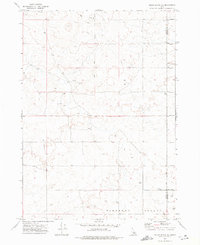
1972 Map of Pillar Butte NE
USGS Topo · Published 1977About this map
Pleasant Valley and the surrounding high desert of southeastern Idaho characterize this 1970s topographic study. The landscape is defined by vast, open terrain marked by volcanic features such as Flat Top, providing a detailed look at the rural expanse along the Power and Bingham County line. The area is largely undeveloped, with a network of Jeep Trails providing the primary means of navigation through the sagebrush and basalt-strewn plains. Local industry and infrastructure are sparse, noted only by a handful of scattered wells and a single Borrow Pit. This map is particularly useful for those studying the physical geography of the Snake River Plain or tracing the historical boundaries of the surrounding counties before modern development altered these remote stretches of the Idaho interior.
Find a feature on this map
6 named features on this map. Tap any name to fly to it.
Don’t see what you’re looking for? This feature index may not catch every label — zoom into the map to look around manually.
Map Details
Editions of this 1972 Pillar Butte NE Map
This is the sole edition of this map. No revisions or reprints were ever made.
Other maps of this area

1934 · American Falls
USGS Topo · 1:62,500

1936 · American Falls
USGS Topo · 1:62,500

1954 · Pocatello
USGS Topo · 1:250,000

1955 · Idaho Falls
USGS Topo · 1:250,000

1958 · Idaho Falls
USGS Topo · 1:250,000

1958 · Pocatello
USGS Topo · 1:250,000
1971 · American Falls SW
USGS Topo · 1:24,000

1971 · American Falls NW
USGS Topo · 1:24,000
1972 · Rattlesnake Butte
USGS Topo · 1:24,000
1972 · Pillar Butte SE
USGS Topo · 1:24,000