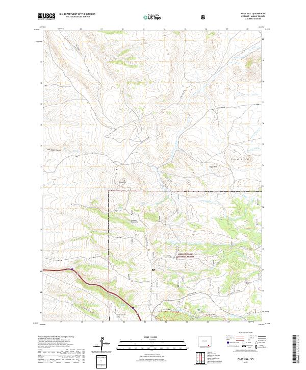
2021 Map of Pilot Hill
USGS Topo · Published 2021About this map
Pilot Hill and the surrounding Laramie Mountains define this high-altitude landscape in the southeastern corner of Wyoming. The eastern portion of the map is dominated by the Medicine Bow National Forest, where a network of trails and service roads, such as Pilot Hill Trl and Horse Creek Trl, wind through the terrain. The hydrology of the area is characterized by drainage systems like Horse Cr and N Lodgepole Cr, which are fed by several localized water sources including Laycock Spring and Telephone Spring. Evidence of human movement across this difficult terrain is found in the south, where Telephone Canyon and Government Gully align with historical transportation corridors. Notable geographic landmarks like Peggy Rock and the Pinnacle Peaks provide significant navigation points for those exploring the backcountry or tracing family-named features in Albany County.
Find a feature on this map
33 named features on this map. Tap any name to fly to it.
Don’t see what you’re looking for? This feature index may not catch every label — zoom into the map to look around manually.
Map Details
Editions of this 2021 Pilot Hill Map
This is the sole edition of this map. No revisions or reprints were ever made.
Other maps of this area

1895 · Laramie
USGS Topo · 1:125,000

1902 · Laramie
USGS Topo · 1:125,000

1905 · Sherman
USGS Topo · 1:125,000

1905 · Laramie
USGS Topo · 1:125,000

1906 · Laramie
USGS Topo · 1:125,000

1908 · Laramie
USGS Topo · 1:125,000

1948 · Sherman Mountains
USGS Topo · 1:62,500

1948 · Ragged Top Mountain
USGS Topo · 1:62,500

1950 · Ragged Top Mountain
USGS Topo · 1:62,500

1950 · Sherman Mountains
USGS Topo · 1:62,500