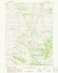
1987 Map of Pilot Hill
USGS Topo · Published 1987About this map
Medicine Bow National Forest dominates the southeastern terrain of this high-country survey, where the headwaters of the Lodgepole Creek system begin their descent. The landscape is defined by the significant prominence of Pilot Hill and the distinctive rock formations of Peggy Rock and Pinnacle Peaks. A complex network of drainage basins is visible, including Rabbit Creek Canyon and the notable Telephone Canyon, which follows a path alongside Government Gully.
Find a feature on this map
19 named features on this map. Tap any name to fly to it.
Don’t see what you’re looking for? This feature index may not catch every label — zoom into the map to look around manually.
Map Details
Editions of this 1987 Pilot Hill Map
This is the sole edition of this map. No revisions or reprints were ever made.
Other maps of this area

1895 · Laramie
USGS Topo · 1:125,000

1902 · Laramie
USGS Topo · 1:125,000

1905 · Sherman
USGS Topo · 1:125,000

1905 · Laramie
USGS Topo · 1:125,000

1906 · Laramie
USGS Topo · 1:125,000

1908 · Laramie
USGS Topo · 1:125,000

1948 · Sherman Mountains
USGS Topo · 1:62,500

1948 · Ragged Top Mountain
USGS Topo · 1:62,500

1950 · Ragged Top Mountain
USGS Topo · 1:62,500

1950 · Sherman Mountains
USGS Topo · 1:62,500